AcroCamp: What’s wrong with this picture?
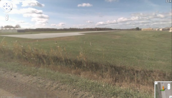
Here’s a screengrab from Google Street View. The view is from Indian Trail which passes beside Ray Community Airport, the location of next week’s AcroCamp 2. Anything hit you about this pic?

First, the end of the runway (Rwy 27) is very close to the public road from which Google did its survey. That’s good, but… The most dramatic thing to my eye is: there’s no airport fence. It’s just a friendly, grass-roots, open airport that everyone is welcome to. Awesome.
(One disadvantage: nothing through which to entwine one’s fingers.)

To answer the question posed in the title: absolutely nothing!
That there are still places like this in the US only indicates they haven’t caught up with us all yet.
That’s a good thing.
Reminds me of Stearman Field, formerly known as Benton Airpark (1K1, nonetheless…)
Couldn’t find a street view but this top-town shot is accurate; the arrival end of Runway 17 is similarly close to a road, there’s no fence…and it sports an great little restaurant/bar with a covered patio that faces the main ramp…they’re rare but out there…
http://maps.google.com/maps?oe=utf-8&rls=org.mozilla:en-US:official&client=firefox-a&um=1&ie=UTF-8&q=Stearman+Field&fb=1&gl=us&hq=Stearman+Field&hnear=0x87badb6ad27f182d:0x9396d5bf74d33d3e,Wichita,+KS&cid=0,0,15538832228343448108&ei=LJlWTuDMLZOAsgKim5TDDA&sa=X&oi=local_result&ct=image&ved=0CAQQ_BI
Similarly